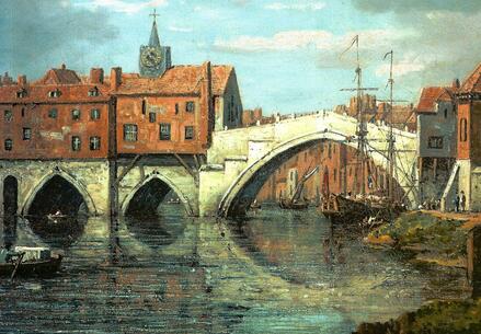
This is William Marlow's beautiful painting of Ouse Bridge around 1760 (York Art Gallery). The large elegant central span of this bridge replaced two arches of the earlier structure, which were washed away in a flood in 1564-5.
This bridge was replaced by the one we have today in 1820. |
York is a city of two rivers, the mighty Ouse and the tiny Foss. They are mighty and tiny, in terms of their catchment areas, but both can cause major flooding and the history of their crossing points still resonate today in the layout of the city and its road system. People lived, fished and traded along the rivers long before the Romans arrived in AD71.
They built the first timber bridge, close to the medieval tunnel under the Guildhall known as Common Hall Lane. That bridge was repaired over the centuries and eventually replaced during York's Anglo-Scandinavian period, with a new timber bridge connecting their new road layout from Ousegate to Micklegate, which we still have today. That bridge collapsed under the weight of the crowd greeting the exiled Archbishop William, when he returned to York in 1154 and was replaced by a stone structure with small multiple arches, pictured left. |
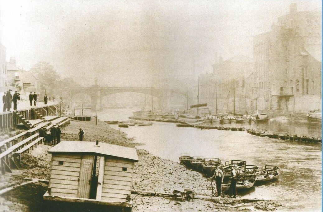
Around 1900, sluices at Naburn weir were opened to lower water levels so York's new sewer pipes could be installed. The river was effectively at low tide, as shown in this photograph from Imagine York.
In 2016, FFH members, Judy Nicholson and Chris Rainger, gave a talk to the Society about the history of the river. You can download a PDF of their presentation HERE |
Did you know there was a ferry across the Ouse on New Walk?
It ran from the Ambrose Street steps to a rough ramp up the west bank and its users included workers at Terry's staff. Members of the wonderful 'York Past and Present' facebook page have been sharing memories and photographs of the ferry and life in the nearby streets. FFH has been given permission to collate their contributions for this website and you can download it HERE. |
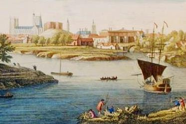
This picture by Francis Place, shows the confluence of the Ouse and Foss before New Walk and Blue Bridge were constructed, with St George's Field between them.
Castle Mills and the adjacent stone bridge can be seen up Brownie Dike, with the prison rising up behind. Men on the west bank are pulling the ship up river |